|
Geometrics
Magnetometers, Seismic & EM Systems
- Geophysical exploration equipment for seismic, magnetic &
electrical methods. Includes proton and
cesium magnetometers, drone and airborne magnetometers, reflection and refraction seismographs,
marine seismics, CDP cable and geophones, Stratagem
conductivity imaging system, and others ... more |
GSSI Ground Penetrating Radar- Ground Penetrating Radar (GPR) equipment for utility detection & mapping, NDT (non-destructive testing) of concrete, mining, engineering geology, environmental, forensic, archaelogy, and other applications ... more
|
Nuclear Magnetic Resonance for groundwater exploration Nuclear Magnetic Resonance (NMR) is the only remote/geophysical method that can directly detect water … all other methods detect associated parameters, not the actual presence of water 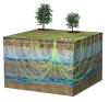 |
|
Borehole logging for exploration, groundwater, hydrology and geophysical surveys. Suppliers of a wide range of logging and winch units, and downhole probes ... more
Eos Positioning Systems (Eos) makes high-accuracy location easy, affordable and profitable. Select the iOS, Android or Windows device of your choice, run the field data collection app that fits your needs, and start using external Bluetooth GPS / GNSS instantly. Your Arrow Series™ receiver lets you collect, update and share submeter, subfoot and centimeter locations in real time ... more
Geostuff - a range of seismic rollalong switches, wall-lock borehole geophones, and ground penetrating radar, as well as various accessories for seismic surveys ... more
|
CMD-DUO "Loop Loop" FDEM System
An affordable “loop-loop” frequency domain EM system suitable for
exploration & mapping of minerals, groundwater and other resources, to
depths of approx 60m. Magnetic Susceptibility Meters - "Pocketsize" magnetic susceptibility meters, for field use ... more
Spectrometers & Scintillometers - A wide range of handheld & airborne spectrometers and scintillometers for exploration ... more
Seismometers & Vibration Monitoring Systems We are able to supply a range of seismometers for various applications, including earthquake monitoring & blast & vibration monitoring ... for more info please contact us WellCAD is PC based composite log package, which combines comprehensive graphic editing mechanisms and data processing tools.
Combining technically excellent display, editing and analysis capabilities for well data, WellCAD has become the standard log composite software in the Mining, Oil&Gas and Geotechnical society and is used in a wide range of applications. The basic module incorporates all features and tools necessary to import, edit, process and display your Well data. The software is delivered with a set Templates, Header, Dictionaries customized for specific application. You can easily modify existing ones or create you own. ... more |
ARES DC Resisitivity & IP System - a suite of geophysical instruments designed for the rapid collection and interpretation of DC resisitivity, induced polarization (IP) and self-potential (SP) data ... more
Miscellaneous Geophysical & Laboratory Instruments - including gamma ray spectrometers, radon progeny monitors, scintillation & Geiger-Muller radiometers, single- and multi-electrode DC resistivity systems, soil & shallow conductivity meters, magnetic susceptibility meters ("kappameters"), and chloride analysers ... more Oasis Montaj, Res2DInv, Res3DInv, Workbench & SPIA Visualise, analyse, and integrate all your geoscience
data in interactive 2D and 3D models
TerrSet is an integrated geospatial software system for monitoring
and modeling the earth system for sustainable development. The TerrSet
system incorporates the IDRISI GIS Analysis and IDRISI Image Processing
tools along with a constellation of vertical applications. TerrSet
offers the most extensive set of geospatial tools in the industry in a
single, affordable package. There is no need to buy costly add-ons to
extend your research capabilities.
|
| Int'l Code:+27 - Area Code: (0)11 - Ph:467-3371 - Mobile:082 89 29 771 - reddog@geoafrica.co.za | ||


